이 제출물을 팔로우합니다
- 팔로우하는 게시물 피드에서 업데이트를 확인할 수 있습니다
- 정보 수신 기본 설정에 따라 이메일을 받을 수 있습니다
This toolbox was constructed to help analyze changing river planforms (aerial views). Given a binary mask of a river, tools are provided to efficiently compute
- channel centerline
- banklines
- channel width (two methods)
- centerline direction
- centerline curvature
If multiple input mask images contain georeference information, a tool is provided to "stitch" the masks together--before or after analysis. Stitching can be done for both images and vectors of x,y coordinates. The mapping toolbox is required for this functionality.
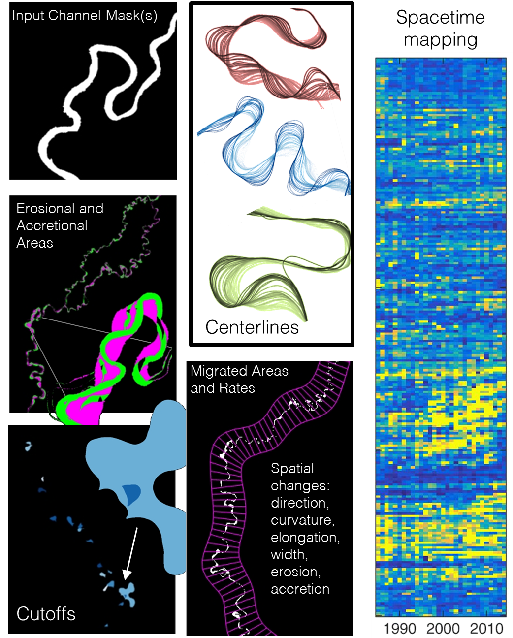
If multiple masks (realizations in time) of the river are available, RivMAP includes tools to
- compute centerline migrated areas
- compute erosional and accretional areas
- identify cutoff areas and quantify cutoff length, chute length, and cutoff area
- generate channel belt boundaries and centerline
- measure and map changes (in width, migration areas or rates, centerline elongation, accreted/eroded areas) in space and time
A demo is provided to highlight some of RivMAP's features that includes 31 years of channel mask data from the Ucayali River in Peru. See the following Open Access article for details of RivMAP and its application to over 1,300 km of the Ucayali River: http://onlinelibrary.wiley.com/doi/10.1002/2016EA000196/abstract
인용 양식
Jon (2026). RivMAP - River Morphodynamics from Analysis of Planforms (https://kr.mathworks.com/matlabcentral/fileexchange/58264-rivmap-river-morphodynamics-from-analysis-of-planforms), MATLAB Central File Exchange. 검색 날짜: .
도움
도움 받은 파일: SAVFILT, Fast and Robust Curve Intersections, interparc, getkey
도움 준 파일: MorphEst - Estuary planform geometry
