Simulation 3D Radar Data Generator
Libraries:
Simulink 3D Animation /
Simulation 3D /
Sensors
Description
Note
Simulating models with the Simulation 3D Radar Data Generator block requires Radar Toolbox.
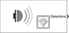
The Simulation 3D Radar Data Generator block generates detection and track reports of targets from a radar sensor model. Use this block to generate sensor data from actors in the 3D simulation environment. This environment is rendered using the Unreal Engine® from Epic Games®.
The Simulation 3D Radar Data Generator block can generate clustered or unclustered detections with added random noise and can also generate false alarm detections. You can also generate tracks. Use the Format of generated target reports parameter to specify whether targets are output as clustered detections, unclustered detections, or tracks.
Tip
The Simulation 3D Scene Configuration
block must execute before the Simulation 3D Radar Data Generator block. That way, the Unreal Engine 3D visualization environment prepares the data before the
Simulation 3D Radar Data Generator block receives it. To check the block execution order,
right-click the blocks and then click the Properties button ![]() . On the General tab, confirm these
Priority settings:
. On the General tab, confirm these
Priority settings:
Simulation 3D Scene Configuration —
0Simulation 3D Radar Data Generator —
1
For more information about execution order, see Control and Display Execution Order (Simulink).
The Coordinate system parameter of the block specifies how the actor transformations are applied in the 3D environment. The output of the block also follows the specified coordinate system.
Limitations
To detect targets, the Simulation 3D Radar Data Generator block implements ray tracing to obtain information about objects in the scene. If an object is small or located far from the sensor, the ray tracing algorithm might not detect the object. To detect smaller scene objects, consider increasing the values of the Resolution Settings parameters. Higher resolution requires more computational resources.
Oversampling in scenes with a large number of objects might reduce simulation speed.
Ports
Output
Parameters
Mounting
Sensor Identification
Unique sensor identifier, specified as a positive integer. Use this parameter to distinguish between detections or tracks that come from different sensors in a multisensor system. Specify a unique value for each sensor.
Specify the name of the parent to which the sensor is mounted. The block provides a
list of parent actors in the model. The names that you can select correspond to the
values of the Name parameters of the Simulation 3D
blocks in your model. If you select Scene Origin, the block
places a sensor at the scene origin. The Custom option allows
you to specify the name of any actor, including child actors in the environment, as the
parent actor.
Example: SimulinkVehicle1
Specify the name of custom parent. This parameter allows you to set any actor in the environment, including child actors as the parent actor to which the sensor is mounted. The name corresponds to the Name parameter of the Simulation 3D block.
Example: SimulinkVehicle1
Dependencies
To enable this parameter, set Parent name to
Custom.
Specify the coordinate system that the actor uses for translation and rotation in the 3D environment.
Default– World coordinate system. Units are in m and rad.MATLAB– MATLAB coordinate system. Units are in m and rad.ISO8855– ISO 8855 standard coordinate system. Units are in m and deg.AERO– SAE coordinate system. Units are in m and rad.VRML– X3D ISO standard coordinate system. Units are in m and rad.SAE– SAE coordinate system. Units are in m and rad.
For more details on the different coordinate systems, see Coordinate Systems in Simulink 3D Animation.
Example: MATLAB
Sensor Mounting
Sensor mounting location.
When Parent name is
Scene Origin, the block mounts the sensor to the origin of the scene. You can set the Mounting location toOriginonly. During simulation, the sensor remains stationary.When Parent name is
sim3dactor name, the block mounts the sensor to the origin of the actor, which is the center of the shape. You can set the Mounting location toOriginonly. During simulation, the sensor travels with the actor.When Parent name is the name of a vehicle, the block mounts the sensor to one of the predefined mounting locations described in the table. During simulation, the sensor travels with the vehicle. For example, the table provides the mounting locations in the ISO 8855 standard coordinate system.
Mounting Location Description Orientation Relative to Vehicle Origin [Roll, Pitch, Yaw] (deg) OriginForward-facing sensor mounted to the vehicle origin, which is on the ground and at the geometric center of the vehicle (see Coordinate Systems in Simulink 3D Animation).

[0, 0, 0] Front bumperFront centerForward-facing sensor mounted to the front bumper

[0, 0, 0] Rear bumperRear centerBackward-facing sensor mounted to the rear bumper

[0, 0, 180] Right mirrorDownward-facing sensor mounted to the right side-view mirror

[0, –90, 0] Left mirrorDownward-facing sensor mounted to the left side-view mirror

[0, –90, 0] Rearview mirrorForward-facing sensor mounted to the rearview mirror, inside the vehicle

[0, 0, 0] Hood centerForward-facing sensor mounted to the center of the hood

[0, 0, 0] Roof centerForward-facing sensor mounted to the center of the roof

[0, 0, 0] The X-Y-Z mounting location of the sensor relative to the vehicle depends on the vehicle type. To specify the vehicle type, use the Type parameter of the Simulation 3D Vehicle with Ground Following to which you mount the sensor. To obtain the X-Y-Z mounting locations for a vehicle type, see the reference page for that vehicle.
Select this parameter to specify an offset from the mounting location by using the Relative translation [X, Y, Z] and Relative rotation [Roll, Pitch, Yaw] parameters.
Translation offset relative to the mounting location of the sensor, specified as a real-valued 1-by-3 vector of the form [X, Y, Z].
You can mount the sensor to a vehicle by setting Parent name
to the name of that vehicle. The origin is the mounting location specified in the
Mounting location parameter. This origin is different from the
vehicle origin, which is the geometric center of the vehicle. You can also mount the
sensor to the scene origin by setting Parent name to
Scene Origin.
Example: [0,0,0.01]
Rotational offset relative to the mounting location of the sensor, specified as a real-valued 1-by-3 vector of the form [Roll, Pitch, Yaw]. Roll, pitch, and yaw are the angles of rotation about the X-, Y-, and Z-axes, respectively.
You can mount the sensor to a vehicle by setting Parent name
to the name of that vehicle. The origin is the mounting location specified in the
Mounting location parameter. This origin is different from the
vehicle origin, which is the geometric center of the vehicle. You can also mount the
sensor to the scene origin by setting Parent name to
Scene Origin. The rotation order is
Roll, then Pitch, then
Yaw. When you update any of the three rotation values and leave
others unchanged, the software reapplies all three rotations in the same order.
Example: [0,0,10]
Sample time of the block, in seconds, specified as a positive scalar. The 3D simulation environment frame rate is the inverse of the sample time.
If you set the sample time to -1, the block inherits its sample time from
the Simulation 3D Scene Configuration block.
Parameters
Detection Reporting
Select this check box to model a radar sensor that can estimate target elevation.
Select this check box to enable the radar to measure range rates from target detections.
Select this parameter to add noise to the radar measurements. Otherwise, the
measurements have no noise. Even if you clear this parameter, the measurement noise
covariance matrix, which is reported in the MeasurementNoise field
of the generated detections output, represents the measurement noise that is added
when you select Add noise to measurements.
Select this parameter to enable creating false alarm radar measurements. If you clear this parameter, the radar reports only actual detections.
Specify the maximum number of detections or tracks that the sensor reports as a positive integer. The sensor reports detections in the order of increasing distance from the sensor until reaching this maximum number.
Format of generated target reports, specified as one of these options:
Clustered detections— The block generates target reports as clustered detections, where each target is reported as a single detection that is the centroid of the unclustered target detections. The block returns clustered detections at the Clustered detections output port.Tracks— The block generates target reports as tracks, which are clustered detections that have been processed by a tracking filter. The block returns clustered detections at the Tracks output port.Detections— The block generates target reports as unclustered detections, where each target can have multiple detections. The block returns clustered detections at the Detections output port.
Coordinate system of reported detections, specified as one of these options:
Body— Detections are reported in the rectangular body system of the ego vehicle.Sensor rectangular— Detections are reported in the rectangular body system of the radar sensor.Sensor spherical— Detections are reported in a spherical coordinate system that is centered at the radar sensor and aligned with the orientation of the radar on the ego vehicle.
Since R2026a
Select this parameter to visualize the radar coverage in the 3D environment. This parameter enables visualization of the field of view with a segmented sphere to annotate the boundaries and extent of the field of view. This parameter uses the Range limits [MIN, MAX] (m) parameter value to visualize the radar coverage in the 3D environment.
Measurements
Resolution Settings
Azimuth resolution of the radar, specified as a positive scalar. The azimuth resolution defines the minimum separation in azimuth angle at which the radar can distinguish between two targets. The azimuth resolution is typically the 3 dB downpoint of the azimuth angle beamwidth of the radar. Units are in degrees.
Elevation resolution of the radar, specified as a positive scalar. The elevation resolution defines the minimum separation in elevation angle at which the radar can distinguish between two targets. The elevation resolution is typically the 3 dB downpoint of the elevation angle beamwidth of the radar. Units are in degrees.
Dependencies
To enable this parameter, select the Enable elevation angle measurements check box.
Range resolution of the radar in meters, specified as a positive real scalar. The range resolution defines the minimum separation in range at which the radar can distinguish between two targets. Units are in meters.
Range rate resolution of the radar, specified as a positive real scalar. The range rate resolution defines the minimum separation in range rate at which the radar can distinguish between two targets. Units are in meters per second.
Dependencies
To enable this parameter, on the Parameters tab, select the Enable range rate measurements check box.
Bias Settings
Azimuth bias fraction of the radar, specified as a nonnegative scalar. Azimuth bias is expressed as a fraction of the azimuth resolution specified in the Azimuth resolution (deg) parameter. This value sets a lower bound on the azimuthal accuracy of the radar and is dimensionless.
Elevation bias fraction of the radar, specified as a nonnegative scalar. Elevation bias is expressed as a fraction of the elevation resolution specified in the Elevation resolution (deg) parameter. This value sets a lower bound on the elevation accuracy of the radar and is dimensionless.
Dependencies
To enable this parameter, select the Enable elevation angle measurements check box.
Range bias fraction of the radar, specified as a nonnegative scalar. Range bias is expressed as a fraction of the range resolution specified by the Range resolution (m) property. This property sets a lower bound on the range accuracy of the radar and is dimensionless.
Range rate bias fraction of the radar, specified as a nonnegative scalar. Range rate bias is expressed as a fraction of the range rate resolution specified by the Range rate resolution (m/s) parameter. This property sets a lower bound on the range rate accuracy of the radar and is dimensionless.
Dependencies
To enable this parameter, select the Enable range rate measurements check box.
Detector Settings
Angular field of view of the radar, specified as a 1-by-2 positive real-valued
vector of the form [azfov elfov]. The field of view defines the
total angular extent spanned by the sensor. The azimuth field of view,
azfov, must lie in the interval (0, 360]. The elevation field of
view, elfov, must lie in the interval (0, 180]. Units are in
degrees.
Minimum and maximum range of the radar, specified as a 1-by-2 nonnegative
real-valued vector of the form [min max]. The radar does not detect
targets that are outside this range. The maximum range, max, must
be greater than the minimum range, min. Units are in meters.
Minimum and maximum range rate of radar as a 1-by-2 real-valued vector of the form
[min max]. The radar does not detect targets that are outside
this range rate. The maximum range rate, max, must be greater than
the minimum range rate, min. Units are in meters per second.
Dependencies
To enable this parameter, select the Enable range rate measurements check box.
Probability of detecting a target as a scalar, specified as a scalar in the range (0, 1]. This quantity defines the probability of detecting a target with a radar cross-section, with the radar cross-section specified by the Reference target RCS (dBsm) parameter at the reference detection range specified by the Reference target range (m) parameter. Units are dimensionless.
False alarm report rate within each radar resolution cell, specified as a positive real scalar in the range [10–7, 10–3]. The block determines resolution cells from the Azimuth resolution (deg) and Range resolution (m) parameters and, when enabled, from the Elevation resolution (deg) and Range rate resolution (m/s) parameters. Units are dimensionless.
Reference range for the given probability of detection and the given reference radar cross-section (RCS) , specified as a positive real scalar. The reference range is the range at which a target having a radar cross-section specified by the Reference target RCS (dBsm) parameter is detected with a probability of detection specified by the Detection probability parameter. Units are in meters.
Reference radar cross-section (RCS) for a given probability of detection and reference range, specified as a real scalar. The reference RCS is the RCS value at which a target is detected with a probability specified by the Detection probability parameter at the specified Reference target range (m) parameter value. Values are expressed in dBsm.
Center frequency of the radar band, specified as a positive scalar. Units are in Hz.
Random Number Generator Settings
Method to set the random number generator seed as one of the options in the table.
| Option | Description |
|---|---|
Repeatable | The block generates a random initial seed for the first
simulation and reuses this seed for all subsequent simulations. Select
this parameter to generate repeatable results from the statistical sensor
model. To change this initial seed, at the MATLAB command prompt, enter: |
Specify seed | Specify your own random initial seed for reproducible results by using the Initial seed parameter. |
Not repeatable | The block generates a new random initial seed after each simulation run. Select this parameter to generate nonrepeatable results from the statistical sensor model. |
Random number generator seed, specified as a nonnegative integer less than 232.
Dependencies
To enable this parameter, set the Select method to specify initial
seed parameter to Specify seed.
Sampling settings
Since R2025a
Select the actor type in the 3D environment around which to improve target detection. This parameter enables the senor to oversample rays towards the specified actor types, improving target detection. Set the parameter as one of the options in the table.
| Option | Description |
|---|---|
None | Disable improved target detection. |
Simulation 3D Vehicles | Enable improved target detection around any vehicle within the sensor field of view. |
Simulation 3D Actors | Enable improved target detection around any actor created using classes or blocks within the sensor field of view. |
All Actors | Enable improved target detection around any actor within the sensor field of view. |
For more information on target detection, see Target Detection.
Tips
Oversampling rays toward actors in the 3D environment increases detection accuracy around the actor and requires more computational resources.
More About
Version History
Introduced in R2024aSee Also
Simulation 3D Scene
Configuration | radarDataGenerator (Radar Toolbox) | objectDetection (Radar Toolbox) | objectTrack (Radar Toolbox) | rcsSignature (Radar Toolbox)