geotickformat
Set or query geographic tick label format
Description
Set Tick Format
geotickformat( sets the format of the
latitude and longitude tick labels for the current geographic axes or map axes. If the
current axes is not a geographic or map axes, or if there is no current axes, then the
function creates a new geographic axes with the specified tick label format. fmt)
You can specify the fmt argument without parentheses. For
example, geotickformat dd sets the tick label format to decimal
degrees.
Examples
Specify the locations and names of three cities in Brazil.
lat = [-23.55 -22.91 -15.79];
lon = [-46.63 -43.2 -47.8828];
n = [" Sao Paulo"," Rio de Janeiro"," Brasilia"];
Display the locations and names using filled markers over the bluegreen basemap.
geoscatter(lat,lon,"filled")
text(lat,lon,n)
geobasemap bluegreen
geolimits([-24.8 -14.5],[-54.6 -37.1])
Change the tick label format to decimal degrees. The -dd option indicates south and west using a minus sign (–).
geotickformat -dd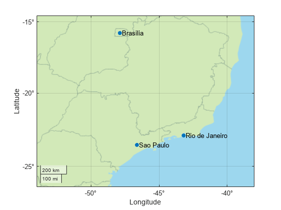
Input Arguments
Output Arguments
Tips
The
geotickformatfunction queries the format stored in theTickLabelFormatproperty of the axes.For geographic axes, if you override the format for an individual axis by setting the
TickLabelFormatproperty of theGeographicRulerobject associated with the axes, then the value returned by thegeotickformatfunction does not match the format of the axis or the displayed map. Setting theTickLabelFormatproperty of an individual axis is not recommended.
Version History
Introduced in R2019a
1 Alignment of boundaries and region labels are a presentation of the feature provided by the data vendors and do not imply endorsement by MathWorks®.