wmlimits
(To be removed) Set or obtain web map limits
The wmlimits function will be removed in a future release. Use a
geographic axes object and the geolimits
function instead. For information on updating your code, see Version History.
Syntax
Description
wmlimits(
center the current web map within the specified latitude limits and the longitude
limits. If there is no current web map, latitudeLimits,longitudeLimits)wmlimits creates one.
Note
The resulting limits often do not match the specified limits because the zoom
level is quantized to discrete integer values and the longitude limits may be
constrained if the map was constructed with the WrapAround
property equal to false.
wmlimits(
centers the web map specified by the web map handle wm,latitudeLimits,longitudeLimits)wm within the
specified latitude limits and longitude limits.
Examples
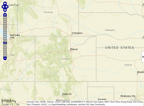
Create a web map that uses the specified latitude and longitude limits.
wmlimits([37 42],[-108.9 -100.7])
Get the latitude and longitude limits of the current web map.
[latitudeLimits,longitudeLimits] = wmlimits()
latitudeLimits =

   34.7311   44.0468


longitudeLimits =

 -113.0397  -96.5603
Input Arguments
Output Arguments
Version History
Introduced in R2013bSee Also
1 Alignment of boundaries and region labels are a presentation of the feature provided by the data vendors and do not imply endorsement by MathWorks®.