라이다 포인트 클라우드 데이터 읽기, 처리하기, 쓰기
R2026b이 예제에서는 포인트 클라우드를 작업 공간으로 읽어오고 원하는 일련의 점들을 선택한 다음 선택한 점들을 포인트 클라우드 파일 형식에 쓰는 방법을 보여줍니다.
1단계: 포인트 클라우드 읽기 및 표시하기
lasFileReader 함수를 사용하여 .las 파일의 데이터를 작업 공간으로 읽어옵니다. 출력 lasFileReader 객체에 저장된 속성을 표시합니다.
fileName = fullfile(toolboxdir("pointcloud"),"pcdata","las","aerialLidarData.laz");
lasReader = lasFileReader(fileName)
lasReader =
  lasFileReader with properties:

                    Count: 1018047
                  XLimits: [4.2975e+05 4.3015e+05]
                  YLimits: [3.6798e+06 3.6801e+06]
                  ZLimits: [72.7900 125.8200]
               Attributes: ["Classification"    "LaserReturn"    "NumReturns"    "ScanDirectionFlag"    "EdgeOfFlightLineFlag"    "ScanAngle"    "UserData"    "PointSourceID"    "GPSTimeStamp"]
       ClassificationInfo: "To get the value, enter lasReader.ClassificationInfo at the Command Window. Learn more"
          LaserReturnInfo: [4×2 table]
    VariableLengthRecords: [3×3 table]

  Show all properties
.las 파일에서 포인트 클라우드를 읽어옵니다.
ptCloud = readPointCloud(lasReader);
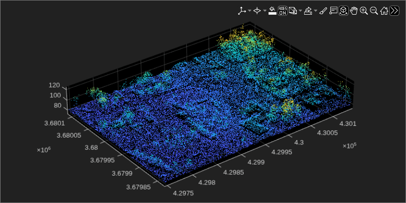
포인트 클라우드를 표시합니다.
fig = figure(Position=[0 0 800 400]);
hPanel = uipanel(fig);
hPlot = axes(hPanel);
pcshow(ptCloud.Location,Parent=hPlot)
2단계: 원하는 일련의 점들을 선택하기
객체 클래스에 대한 분류 값과 ROI(관심 영역) 내 점들의 인덱스를 지정하여 입력 포인트 클라우드에서 원하는 일련의 점들을 선택할 수 있습니다.
분류 값을 지정하여 점 선택하기
분류 값을 지정하여 점들을 선택하려면,
lasFileReader객체의ClassificationInfo속성을 사용하여 입력 포인트 클라우드에서 객체 클래스에 대한 정보를 읽어옵니다.
disp(lasReader.ClassificationInfo)
    Classification Value        Class Name         Number of Points by Class
    ____________________    ___________________    _________________________

             1              "Unclassified"                  114842
             2              "Ground"                        646632
             4              "Medium Vegetation"             210101
             6              "Building"                       45699
             8              "Reserved(8)"                      751
             9              "Water"                             22
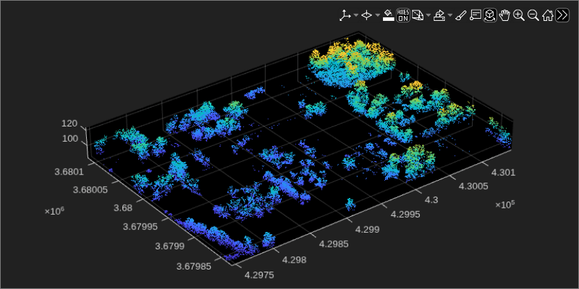
readpointCloud함수를 사용하여 입력 포인트 클라우드에서 읽어올 객체 클래스에 대한 분류 값을 지정합니다. 중간 정도의 초목 영역에 대응하는 점들을 읽어오려면Classification이름-값 인수에 대한 값을 4로 설정합니다.
ptCloudB = readPointCloud(lasReader,Classification=4);
포인트 클라우드를 표시합니다.
fig1 = figure(Position=[0 0 800 400]);
hPanel1 = uipanel(fig1);
hPlot1 = axes(hPanel1);
pcshow(ptCloudB.Location,Parent=hPlot1)
인덱스를 지정하여 점 선택하기
입력 포인트 클라우드의 x, y, z 좌표의 범위 내에서 직육면체 ROI를 정의합니다.
roi = [lasReader.XLimits(1)+200, lasReader.XLimits(2), ...
    lasReader.YLimits(1), lasReader.YLimits(2), lasReader.ZLimits(1), lasReader.ZLimits(2)];
직육면체 ROI 범위 내에 있는 점들의 인덱스를 구합니다.
indices = findPointsInROI(ptCloudB,roi);
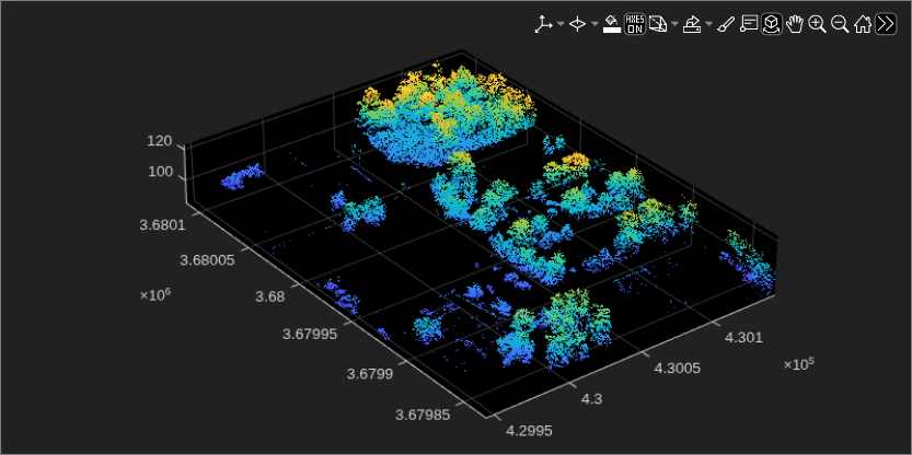
직육면체 ROI 범위 내에 있는 점들을 선택하고 point cloud 객체로 저장합니다.
ptCloudC = select(ptCloudB,indices);
포인트 클라우드를 표시합니다.
fig2 = figure(Position=[0 0 800 400]);
hPanel2 = uipanel(fig2);
hPlot2 = axes(hPanel2);
pcshow(ptCloudC.Location,Parent=hPlot2)
3단계: 선택한 점들을 .las 파일 형식에 쓰기
.las 파일의 이름을 지정하고 lasFileWriter 객체를 만듭니다.
newfileName = "aerialvegetation.las";
lasWriter = lasFileWriter(newfileName);
writePointCloud 함수를 사용하여, 선택한 점들을 .las 파일에 씁니다. 이 함수는 현재 작업 디렉터리에 새 파일을 만듭니다.
writePointCloud(lasWriter,ptCloudC);
4단계: 새로 쓴 파일의 속성 확인하기
newlasReader = lasFileReader(newfileName)
newlasReader =
  lasFileReader with properties:

                    Count: 116598
                  XLimits: [4.2995e+05 4.3015e+05]
                  YLimits: [3.6798e+06 3.6801e+06]
                  ZLimits: [84.9500 123.1100]
               Attributes: ["Classification"    "LaserReturn"    "NumReturns"    "ScanDirectionFlag"    "EdgeOfFlightLineFlag"    "ScanAngle"    "UserData"    "PointSourceID"    "GPSTimeStamp"    "ScannerChannel"]
       ClassificationInfo: "To get the value, enter newlasReader.ClassificationInfo at the Command Window. Learn more"
          LaserReturnInfo: [1×2 table]
    VariableLengthRecords: [1×3 table]

  Show all properties
참고 항목
lasFileReader | pcshow | readPointCloud | findPointsInROI | pointCloud | select

