지형도로 만드는 제약 조건이 적용되는 들로네 삼각분할
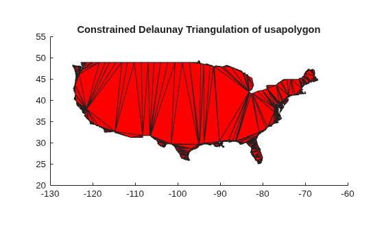
R2026b미국의 외곽 경계를 나타내는 지도를 사용하여 제약 조건이 적용된 들로네 삼각분할을 만듭니다.
국경이 표시된 미국 지도를 불러옵니다.
load usapolygon다각형 경계를 구성하는 두 개의 연속된 점 사이의 모서리 제약 조건을 정의하고 들로네 삼각분할을 생성합니다. 이 삼각분할은 점 집합에 대한 컨벡스 헐(Convex Hull)에 의해 경계가 지정된 영역에 걸쳐 있습니다. 데이터 세트에는 중복된 데이터 점이 포함되어 있습니다. 즉, 위치가 동일한 데이터 점이 두 개 이상 있습니다. 중복된 점은 거부되고 delaunayTriangulation은 이에 따라 제약 조건의 형식을 다시 지정합니다.
nump = numel(uslon);
C = [(1:(nump-1))' (2:nump)'; nump 1];
dt = delaunayTriangulation(uslon,uslat,C);
Warning: Duplicate data points have been detected and removed.
 The Triangulation indices and constraints are defined with respect to the unique set of points in delaunayTriangulation.
Warning: Intersecting edge constraints have been split, this may have added new points into the triangulation.
다각형의 영역 내에 있는 삼각형을 필터링한 후 플로팅합니다.
io = isInterior(dt);
patch(Faces=dt(io,:),Vertices=dt.Points,FaceColor="r")
axis equal
axis([-130 -60 20 55])
title("Constrained Delaunay Triangulation of usapolygon")