Mapping Toolbox Data Sets
Mapping Toolbox™ includes several files that contain data sets for the world and the United States. This topic summarizes useful data sets, but is not a comprehensive list.
World Data
| Filename | Description | How to Load |
|---|---|---|
| Shapefile containing low-resolution world land areas. The
file stores the shapes as polygons with coordinates in latitude
and longitude. The shapes have one attribute:
This data is useful for providing geographic context on small-scale maps. Data Size: 537 rows, 2 variables For more
information, see
edit landareas.txt |
GT = readgeotable("landareas.shp");
geoplot(GT) |
| Shapefile containing world populated places. The file
stores the shapes as points with coordinates in latitude and
longitude. The shapes have one attribute:
Data Size: 318 rows, 2 variables For
more information, see
edit worldcities.txt |
GT = readgeotable("worldcities.shp");
geoplot(GT) |
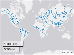
| Shapefile containing low-resolution world rivers. The file
stores the shapes as lines with coordinates in latitude and
longitude. The shapes have one attribute:
Data Size: 128 rows, 2 variables For
more information, see
edit worldrivers.txt |
GT = readgeotable("worldrivers.shp");
geoplot(GT) |
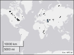
| Shapefile containing low-resolution world lakes and inland
seas. The file stores the shapes as polygons with coordinates in
latitude and longitude. The shapes have one attribute:
Data Size: 37 rows, 2 variables For
more information, see
edit worldlakes.txt |
GT = readgeotable("worldlakes.shp");
geoplot(GT) |
| MAT file containing low-resolution global coastlines. The
file stores the latitude coordinates in
Data Size: Two column vectors with 9865 elements |
load coastlines.mat
geoplot(coastlat,coastlon) |
| Vector MBTiles file containing low-zoom levels of region and land boundaries.a The file was created using data from Natural Earth. Maximum Zoom Level: 5 |
addCustomBasemap("naturalearth","naturalearth.mbtiles",Style="streets") geobasemap naturalearth |
| Raster MBTiles file containing low-resolution USGS imagery. Maximum Zoom Level: 4 |
addCustomBasemap("usgsimagery","usgsimagery.mbtiles") geobasemap usgsimagery |
a Alignment of boundaries and region labels are a presentation of the feature provided by the data vendors and do not imply endorsement by MathWorks®. | ||


United States Data
| Filename | Description | How to Load |
|---|---|---|
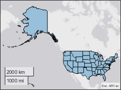
| Shapefile containing moderate-resolution outlines of the
United States and the District of Columbia. The file stores the
shapes as polygons with coordinates in latitude and longitude.
The shapes have three attributes: Data Size: 51 rows, 4 variables For
more information, see
edit usastatehi.txt |
GT = readgeotable("usastatehi.shp");
geoplot(GT) |
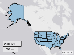
| Shapefile containing low-resolution outlines of the United
States and the District of Columbia. The file stores the states
as polygons with coordinates in latitude and longitude. The
shapes have four attributes: Data Size: 51 rows, 5 variables For more information, see
edit usastatelo.txt |
GT = readgeotable("usastatelo.shp");
geoplot(GT) |